We now have, for the very first time, an accurate mapping of the 1934 excavation cuttings that can be used to locate the various features and finds that Keiller and his team excavated, recovered and recorded. There is still work to do. As you will see, these are the basic cutting shapes and as a result all of the various extensions and alterations I talked about in blog post 5 will need to be added in due course. But it’s a solid start.
As this is digital data, we can use a nifty piece of software called a Geographical Information System (GIS for short) to explore and analyse spatial patterns and relationships at a host of scales.
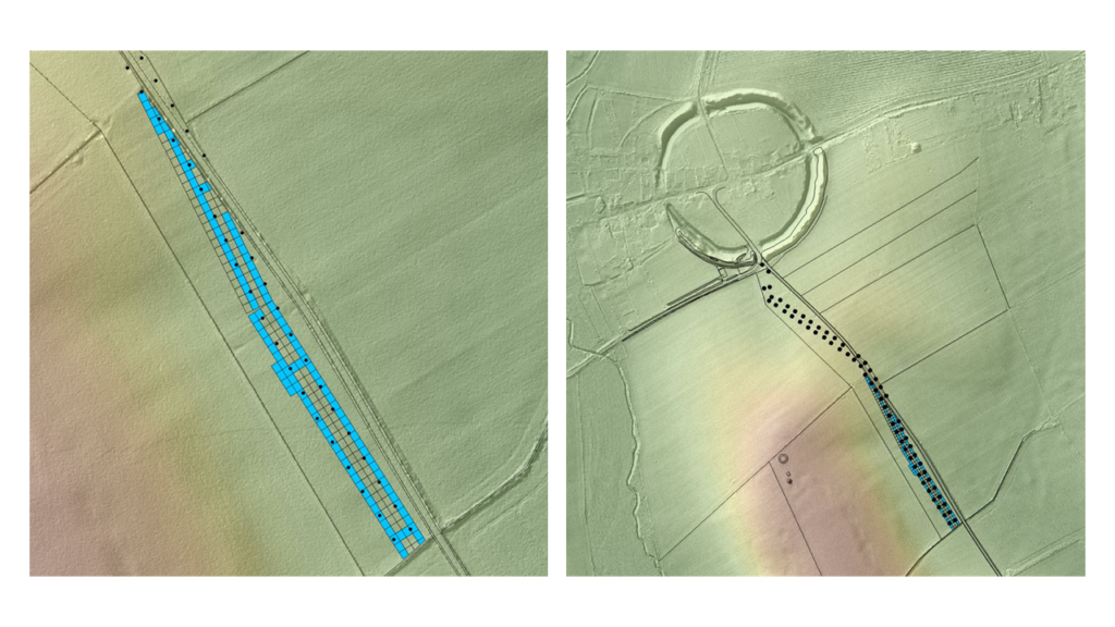
The cuttings displayed using a GIS
This is important as it will not only allow us to anchor the various elements of the site archive in space, but it also enables us to directly relate Keiller’s findings to the results of other archaeological fieldwork that has taken place since the 1930s.
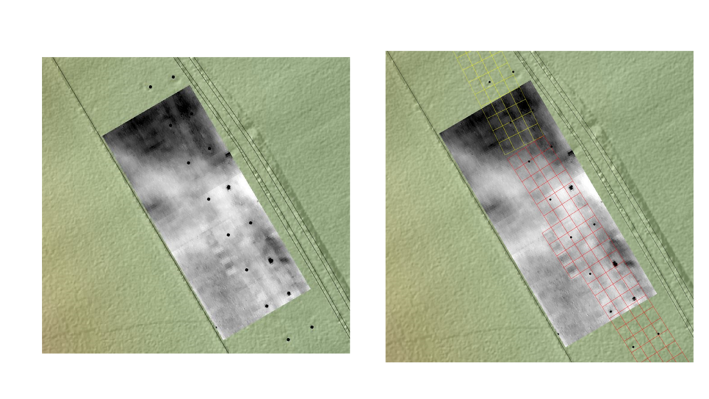
Take for example the results of a geophysical survey (soil resistance) that was undertaken on the Avenue line in 2012 in advance of a campaign of excavation (2013 – 15). When we combine these results with the 1934 data we are immediately able to see how well the geophysical survey data has detected Keiller’s cuttings. We can do the same with the 2013-5 trenches and the features revealed by these more recent excavations.
The 2012 resistivity survey results alongside the newly geo-referenced cuttings plan.
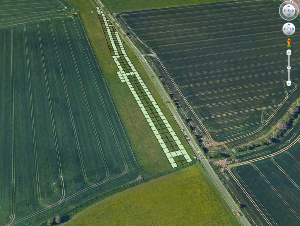
So far so good, but you do not need a GIS in order to view and access the 1934 cuttings. Everyone can make use of the newly located cuttings data using free software such as Google Earth. To that end I have created Google Earth compatible files that everyone can use in order to place Keiller’s 1934 cuttings back into the landscape.
I now need to find a way to share these files with you – so please watch this space!
That’s it for this part of the blog. Next will be 1935, when Keiller decided to take a very different approach to laying out his excavation cuttings; an approach that raises a new set of problems and challenges. See you then.
Visitors to Avebury recently may have witnessed the odd sight of two people walking around with cameras on the end of long poles. Certainly, many people came up to ask what we were doing, and no, it wasn’t part of a mysterious mid-summer ritual!
The truth is sadly more mundane. Adam Stanford of SUMO GeoSurveys (https://www.sumoservices.com/archaeology-geophysical) and I have been conducting a survey of the Avebury and West Kennet Avenue stones using a technique known as photogrammetry, a technique for generating 3d models of objects.
I should add that our survey happened to coincide with a period of beautiful sunny weather. The brilliant sunshine and strong shadow was far from ideal conditions for stone photography, but it was hard to worry about that as the buttercups were out and the West Kennet Avenue was looking rather magical!
Adam Stanford using a camera on a pole to photograph the top of a stone on the West Kennet Avenue.
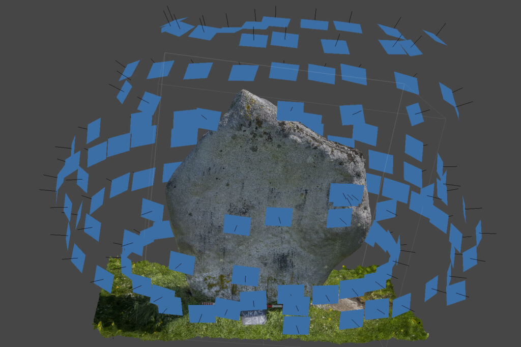
In order to make the photogrammetric model, we take overlapping photos of the stones from every possible angle (hence the long poles). This involved taking roughly 150 shots for each stone. Once the photographs have been taken, we use software to generate a 3d point cloud by triangulating the positions of individual points on a stone using multiple photographs taken from different angles.
The end result is an accurate 3d model of each stone.
Screen capture of the construction of the 3d model. The blue rectangles show the location and direction of each photograph the model is being compiled from.
Those of you that follow the Avebury Papers project will know that the focus of our project is on digitising the archive from Avebury’s 20th century excavations. Therefore, you are probably wondering why we want to survey the stones. The answer is a little convoluted.
The starting point is that there are lots of photographs of Avebury’s stones in the Keiller archive (we estimate there to be 2000 of them!). Many of these are only partial images of stones taken from odd angles as they were being uncovered, or re-erected, in the 1930s. It is quite difficult to identify which stones appear in the photographs but this is information that we would very much like to add to our catalogue so that ultimately people will be able to search for all the images and written records associated with each individual stone on the site.
Whilst trying to work out how we were going to identify these stones, the opportunity came up to work with some clever people at the University of York involved with machine learning. They have set up a project that aims to teach a computer to identify the stones in the photographs for us. I won’t go into more detail here as this part of the project will be covered in detail in a future blog post. Suffice to say, the first step is to give the computer some images of Avebury’s stones to use as a reference point. These photos need to provide the computer data on what every stone looks like from every possible angle, and so the obvious starting point was to create a 3d model of the stones using photogrammetry. A few examples of what the models look like can be seen below.
Beyond teaching a computer to recognise a stone, there are many more reasons why the photogrammetric survey is a great idea.
First of all it will provide accurate 3d survey data that will be essential baseline data for the future management of the monument.
Secondly, the survey opens up lots of avenues for further research. For example, it will allow us to conduct a detailed quantified analysis of the surfaces of the stones. Many of the stones at Avebury have evidence of differing amounts of flaking and pecking of their surfaces. This is of interest as, unlike Stonehenge, Avebury’s stones are often thought of as being natural sarsen boulders that have not been dressed. We will use the photogrammetric model to try and work out how much of the surface alteration of the stones relates to the working of them in prehistory, as opposed to natural weathering, or medieval and later attempts to break or bury the stones.
Ultimately, we aim to survey the whole of the monument, including its banks and ditches. Once this has been done the model will also be able to quantify the volume of its earthworks to a higher level of accuracy than has previously been possible.
Alongside an improved understanding of the pecking and flaking of Avebury’s stones, this information will be an essential component in understanding the scale and complexity of the Neolithic construction of the monument.
For now, though, there is more survey work to be done. We estimate that we may need to take 15,000 photographs before we have captured every stone from every possible angle. So you may well see more people wandering around with cameras on poles in the months to come!
This blog post is part 6 of a series: you may want to read Part 1, Part 2, Part 3, Part 4, and Part 5 first.You can find Part 7 linked at the bottom of the page.
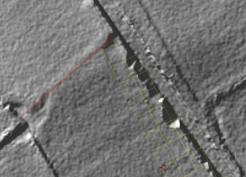
Having reconstructed the process and produced an analogue plot of the final grid arrangement, I was ready to replicate the process ‘on the digital ground’ within a Geographical Information System (GIS).
My starting point was not Keiller’s A-B-C baseline laid out across the line of the Avenue (discussed in Blog post 2) but instead the two points A and B where the sides of Keiller’s corridor intersected the fence that closed off the southern end of the field. Whilst the material of the fence has undoubtedly been replaced since 1934, its line is still in position, as evidenced by a marked lynchet. Keiller had recorded a measurement from its junction with the road to point B, and the distance from B to A could be calculated thanks to Pythagoras. This is exactly what I needed – recognisable 1934 locations that were locatable today.
The survey grid meets the southern fence line. In Keiller’s 1934-5 West Kennet Avenue Plotting Book, accession number 78510469.
Using these known points to light the blue touchpaper, I then converted Keiller’s meticulously measured distances into metric units and used the GIS to recreate his survey. I did this in two blocks, either side of the 6 degree pivot marked by the Triangle of Correction.
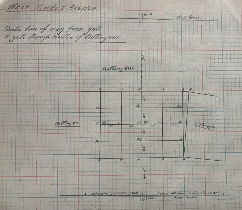
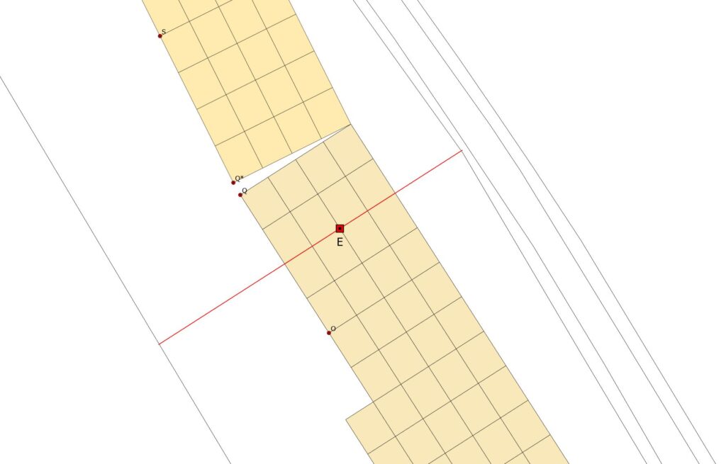
Quality control came in the form of a pair of measurements Keiller took from the midpoint of cutting VIII (at a point he called ‘E’ – see below) along a line perpendicular to the long axis of the grid.
Keiller reaches out. 1934-5 West Kennet Avenue Plotting Book, accession number 78510469.
He extended this line until it reached the fence lines bordering the Avenue field to either side and made a record of the distances. When this line was recreated digitally to Keiller’s measurements the endpoints fell within 7cm of the fence-line to the west and 20cm to the east.
The final check was a simple one: did the end of the grid fall within the northernmost E-W boundary fence? I was mindful that the Avenue line ran up slope for a portion of its course, which meant that Keiller’s chained measurements were not taken on perfectly flat ground (as recorded on the modern map). To put this another way, at times he was measuring slope distances instead of horizontal distances (i.e. the hypotenuse rather than adjacent). Yet I was plotting his measurements as though they were taken on flat ground. Over the 450m or so total length of the grid this could result in stretching.
Using height data derived from LiDAR (and three cups of strong coffee), I measured the rise and fall between each pair of 100’ grid points. I then converted the slope distances into horizontal distances to determine how much stretch had potentially occurred. Across the full 450m this amounted to only 17cm. Stretch was not an issue. Although the fence here had long gone, the lynchet was preserved in the LiDAR data and this could be used to recreate the fence line. Plotting the cuttings against this showed a good fit.
Was I happy with +/- 20cm? After 89 years I certainly was. Especially given the lack of fixed reference points between 1934 and today. Given the high likelihood that there had been some degree of movement in the precise placement of the fences, the slope effects, not to mention the inherent precision and accuracy of the Ordnance Survey digital data I was fixing the grids against, this was perfectly acceptable.
So… almost done. In the final blog post I will look at the final steps that were taken in order to create these digital maps of the 1934 cuttings.
This blog post is part of a series: you may like to explore Part 1, Part 2, Part 3, and Part 4 first.
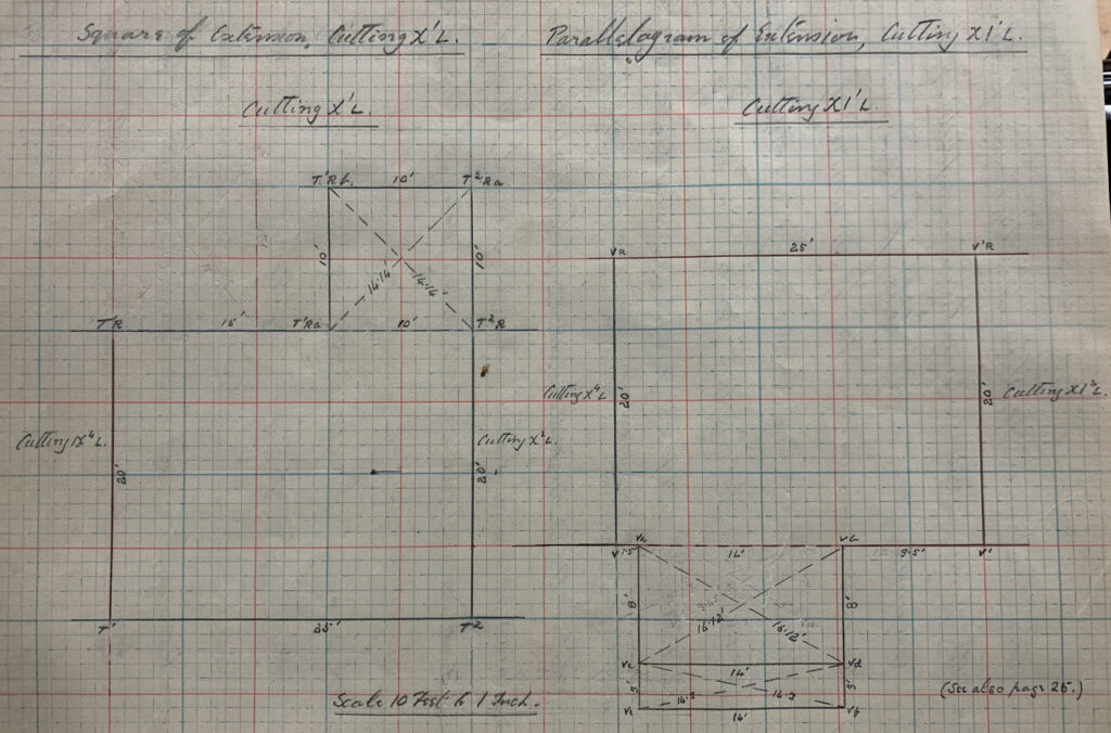
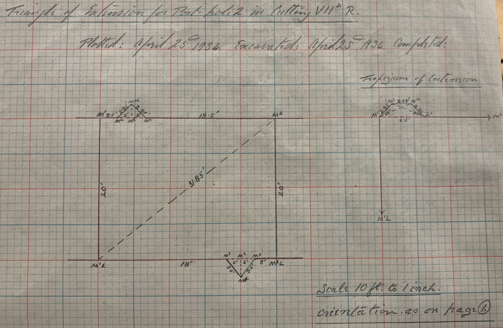
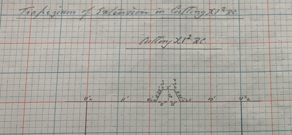
Although I promised that this post would cover the process of geo-referencing – i.e. locating Keiller’s cutting grid on the ground today – I would like to briefly digress and talk a little about the tweaks and alterations Keiller had to make as he went along. In other words, Keiller’s extensions to the grid.
These ‘extensions’ capture for me the essence of Keiller’s perhaps overly meticulous approach. They also hint at his rather long-winded and idiosyncratic writing style* – if you do not believe me compare the text of the 1936 Antiquity interim (penned by Keiller & Piggott) with the 1939 interim (penned by Keiller alone). The latter is chewy.
Keiller’s extensions. 1934-5 West Kennet Avenue Plotting Book, accession number 78510469.
As I noted in previous blog posts, Keiller’s approach to setting out the West Kennet Avenue trenches was rigid and meticulous – ruler-straight baselines and regular gridded corridors of equally sized cuttings laid out to track the course of the paired standing stones.
Sadly, the Avenue itself did not play ball, its course gently curving and arcing as it plodded its way north towards the Avebury henge. To cope with this Keiller took the decision to pivot the entire grid 6 degrees to the northeast, as discussed in blog post 4. He also surveyed in a series of regular geometric extensions to the basic grid to enable his cuttings to encompass the full positions of the component standing stones and other features (such as post holes).
Keiller extends. 1934-5 West Kennet Avenue Plotting Book, accession number 78510469.
I’d have called them extensions (if I called them anything at all). Keiller was more creative. As a result as we read through the notebooks and peruse the plans we encounter the rather lovely Triangle of Extension along with the Trapezium of Extension, the Parallelogram of Extension and the Square of Extension. They sound like cool band names.
Trapezium of extension. 1934-5 West Kennet Avenue Plotting Book, accession number 78510469.
And things could get complicated, as progressive excavation revealed the need for extensions to extensions, leading to my favourite, the frankly awesome Parallelogram of Further Extension. Needless to say, the 6 degree pivot was made possible by the terrifying sounding Triangle of Correction.
Yikes. Extending extensions. 1934-5 West Kennet Avenue Plotting Book, accession number 78510469.
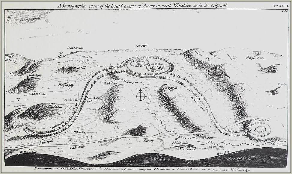
If the West Kennet Avenue had followed a largely straight line (as John Aubrey portrayed it in a drawing carried out shortly after his survey in September 1663), Keiller’s 80’ wide corridor would have done the job. Unfortunately its course was rather sinuous (hats off to William Stukeley) as indicated by a single surviving stone (Keiller’s #34, Smith’s 21A) on the other side of the road running along the eastern edge of the field.
Stukeley’s interpretation of the Avebury landscape, via Wikicommons.
As a result Keiller knew that sooner or later his corridor of regular blocks and cuttings would have to pivot. This eventually came at a distance of just over 243m (800’) from the fence marking the southern end of the field, though it was clear from about 180m that the line of paired standing stones was drifting to the east of the corridor axis. This in turn prompted some nimble footwork (tapework?) on the part of Keiller to modify and extend his cuttings – more about these in a later post.
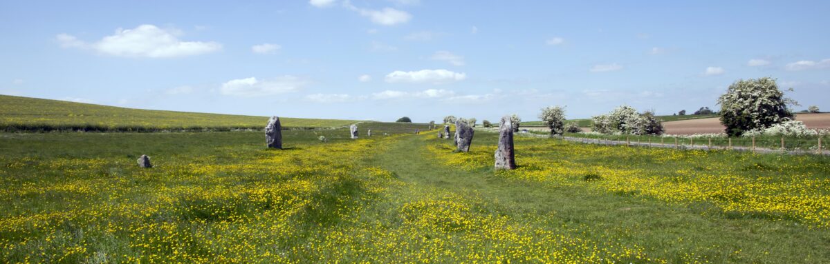
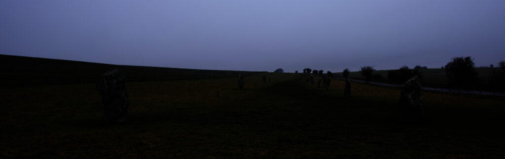
You can get a sense of the drift from the photograph below I took from the midpoint of the avenue on the southern boundary fence looking northwards towards Avebury.
Looking North towards Avebury through West Kennet Avenue.
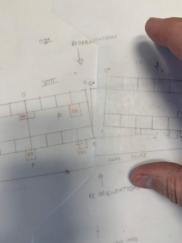
So, using point R as the pivot (marking the 800’ point and north-eastern corner of block VIII – check out the sketch in post #3), he tilted the axis of the entire grid 6 degrees to the east. And then carried on.
Never missing a chance to repurpose a unique identifier, the original north-west corner of block VIII (point Q) was replaced by point Q* precisely 2.499m (8.2’) away. The corridor then trundled on until it met the boundary of the field long its northern edge, slowly intersecting the fenceline on the east as it did so. And that was essentially that.
Pivotting and plotting.
As a visual thinker, the plotting out by hand of the cuttings has proven invaluable in helping me to make sense of the complex textual descriptions and step-by-step annotated drawings in Keiller’s Plotting book. I now understand better not only what he had done, but how he went about doing it.
The next step will be to replicate this digitally in the GIS. The first stage in that process is going to be identifying points on the digital ground today (i.e. the Ordnance Survey map coverage) that correspond to points established in 1934 by Keiller. More of that in the next post.
I have a confession. Much as I admire his surveying chops, Keiller’s approach to numbering and labelling (stones, cuttings, whatever) leaves me sobbing.
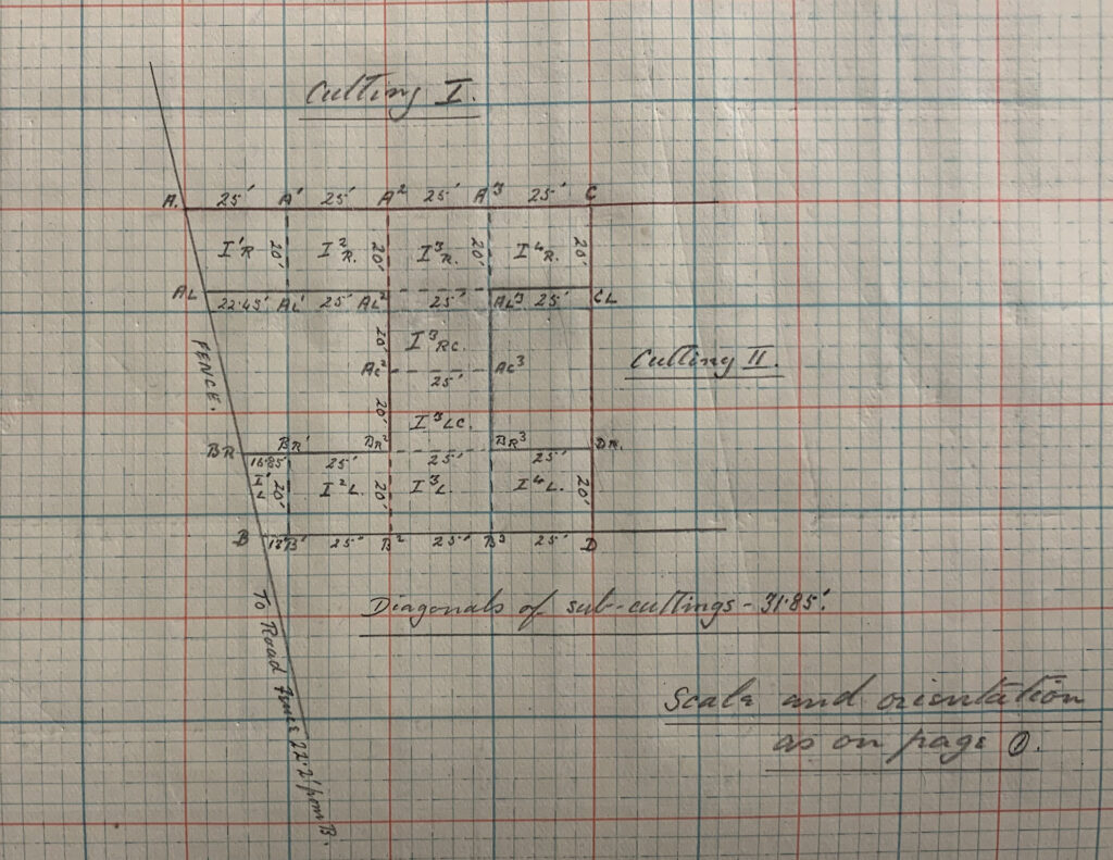
Let me give you a flavour of what I mean. In an earlier post I mentioned that he liked to re-use letter codes for reference points and survey datums/stations. Taking 1934 as an example, ‘A’ and ‘B’ could refer to the mid and end point of the original line he surveyed running across the axis of the Avenue line or the points where the baselines bounding his 80’ wide corridor intersected the fence at the southernmost end of Mr. Peake-Garland’s Waden Hill Field. Take a look at the drawing below from the plotting book and you will see what I mean.
Where the survey blocks met the southernmost fence line crossing the field
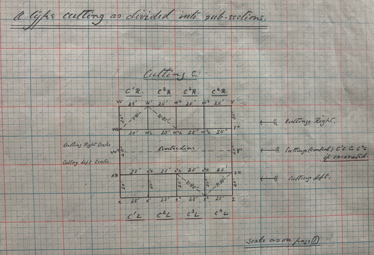
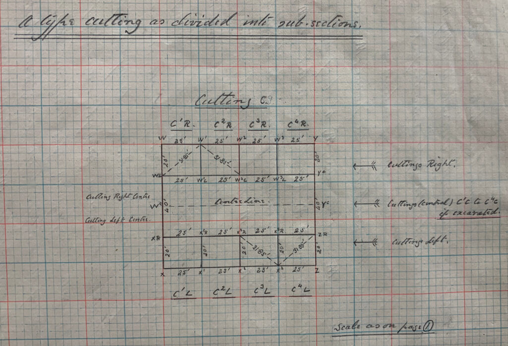
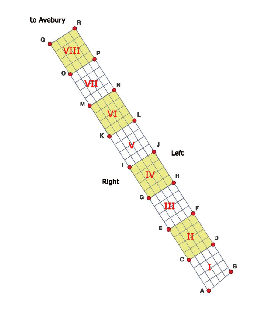
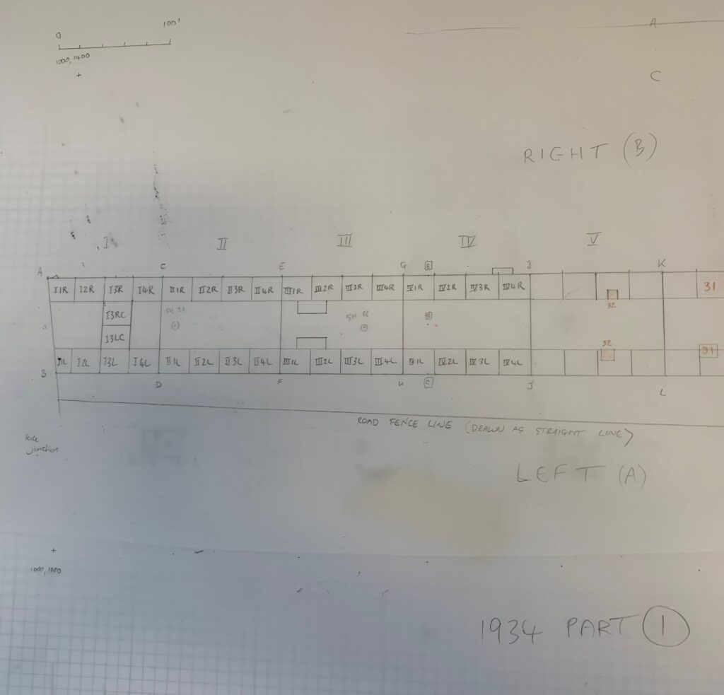
But the real fun has yet to start. He numbered his individual 100 x 80’ survey blocks from south to north, using Roman numerals – I, II, III, IV etc… Each of these blocks in turn contained a total of sixteen 25 x 20’ sub-cuttings – four rows of four. The individual sub-cuttings were given Arabic numbers – also incrementing from south to north – and always indicated in superscript. To differentiate between the two rows of cuttings that ran up either side of the line of 100 x 80’ blocks – i.e. that theoretically tracked the lines of paired megaliths – he used L (Left) and R (Right). However, in deciding which side was Right and which Left, instead of facing north towards Avebury, he faced South, away from it. So… the 3rd cutting of the fourth block on the western side of the Avenue would be sub-cutting IV3R. Its partner on the eastern side would be IV3L. As for the two rows of 25 x 20’ cuttings running down the centre of the Avenue line Keiller added a C to indicate that a given code referred to a central sub-cutting (e.g IV3RC and IV3LC). It was so overwrought that the plotting book included a dedicated diagram to demystify it (see below).
The key to Keiller’s labelling schema
And it gets worse. Keiller gave the corners of each 100 x 80’ block a letter code, moving up through the alphabet from south to north. The diagram I have sketched out below should hopefully clarify.
codes and datums everywhere
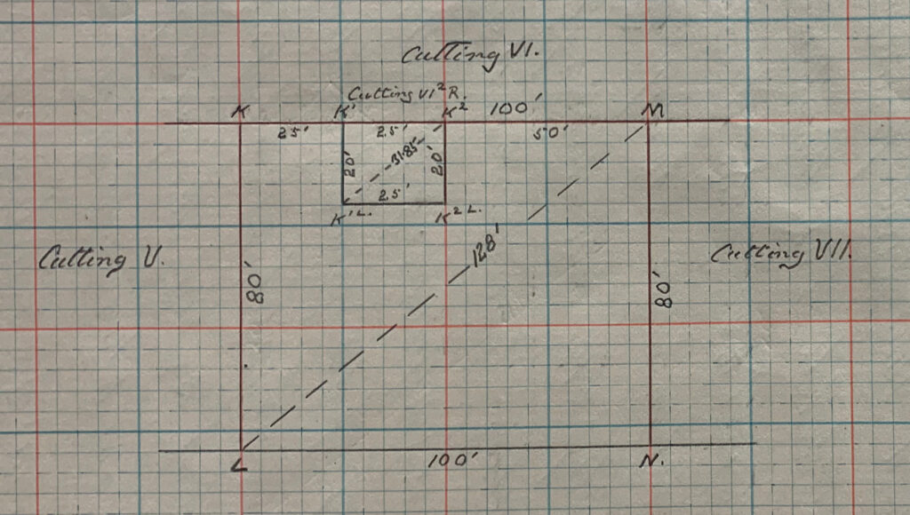
In his descriptions and in plotting book diagrams, the corners of the subdivisions of the cuttings are labelled with respect to these corner designations. So the 2nd sub-cutting on the ‘Right’ hand side of block VI would be designated VI2R and its corner points (moving clockwise) K1, K2, K2L and K1L. Take a look at the subdivision plan below (more on subdivisions and extensions in the next post) and you will get a sense of the complexity that is piling up – and this is just in laying out the trenches.
labelling the sub-cuttings
My final note on the coding relates to the individual standing stones themselves. Here Keiller took a refreshingly simple approach. Each megalith had its own number, starting at the southern extent of his excavation area with standing stone 1 and then incrementing as he moved northwards towards Avebury. So, the southernmost stone pair in Waden Hill Field = stones 1 and 2. The next pair to the north 3 and 4, and so on. Odd numbers on the Right (western) side, even numbers on the Left (eastern) side.
When Isobel Smith produced her synthetic publication of the Avenue excavations, she renumbered. Instead of individual megaliths, she numbered stone pairs (using A to indicate Left and B to indicate Right). She also flipped the numbering strategy on its head, starting at Avebury with Pair 1 and incrementing as one moves south. The logic was faultless: there were undoubtedly more stones waiting to be discovered to the south of Keiller’s Pair 1 and 2, and her approach allowed meaningful numbers to be assigned to them. Irony is in the eye of the beholder, but for me it did add a layer of complexity to what was probably Keiller’s least torturous schema.
That’s me done for now. In the next post we will look at what Keiller did when things did not go to plan (no pun intended).
Next step is to recreate Keiller’s excavation grid using the step-by-step measurements and drawings in his 1934-5 Plotting Book. I could have taken a digital approach from the outset, but to limber up, and better understand how the grid of planned excavation cuttings slowly unfolded on the 10th of April 1934, I began by hand-plotting his measurements, to scale, on a sheet of drawing film.
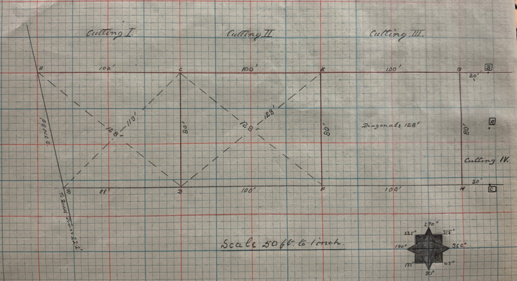
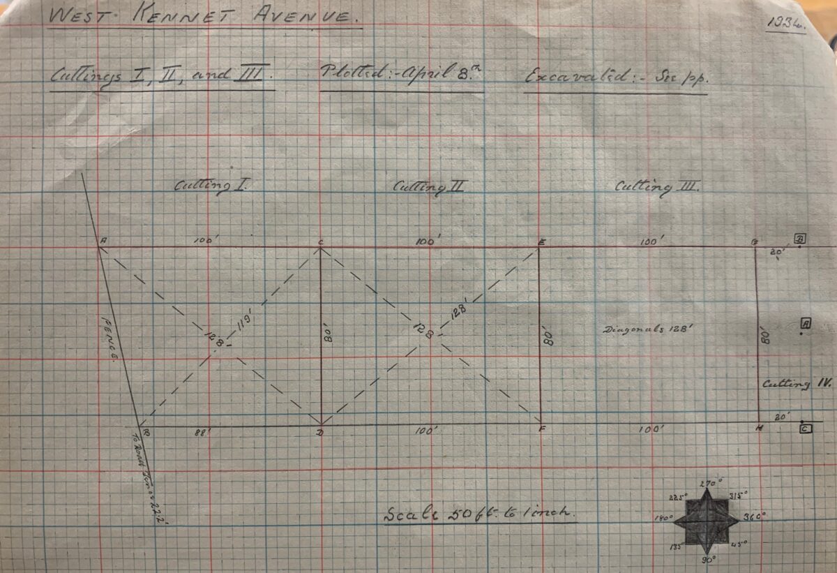
It all began for Keiller with the setting up of a point on the central axis of the Avenue line. The focus of the 1934 excavation was Mr. Peake-Garland’s main Waden Hill field; a strip running north-south alongside the road linking Avebury to West Kennett. Keiller started by establishing a centre line along the main axis of the Avenue at the southernmost end of the field, where 11 surviving stones could be seen (9 fallen and 2 still standing as a pair). He used a tape to measure the midpoint between the southernmost duo of fallen stones (37A and 37B using Smith’s numbering scheme) and did the same between the surviving upright stones 33A and 33B. He then joined the dots to create a notional line running down the centre of the Avenue and established a reference point (labelled A) on this line.
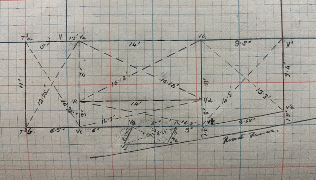
Keiller’s cuttings 1, 2, and 3, showing points A, B, C, D, E, F, G and H along West Kennet Avenue. A page from the 1934 plotting book, accession number 78510469 at the Alexander Keiller Museum.
Using a theodolite the next step was to set out two points perpendicular to A and at a distance of 40’ (12.19m) to the approximate east (C) and west (B) respectively. These points marked the east and westernmost extensions of the grid needed to encompass the width of the Avenue line. So far so good. Using this line of 3 points as a reference, Keiller then set out an 80’ (24.38m) wide corridor running to the northwest towards Avebury. This corridor was subdivided along its length into a series of numbered 100’ x 80’ (30.48 x 24.38m) blocks which were in turn subdivided into parallel lines of 25’ by 20’ (7.62 x 6.09m) cuttings designed to capture the locations of Avenue stones (more on the rather idiosyncratic coding of these blocks and sub-divisions in the next post).
What Keiller and his team had achieved with a theodolite and 100’ survey chains, I was mirroring using a sharp pencil, drawing film and graph paper; working page by page through the plotting book…
Photograph of a page from Keiller's 1934-5 West Kennet Avenue Plotting Book, accession number 78510469, Alexander Keiller Museum. The plotting book is made with graph paper, and on this page are plan drawings of cuttings, or 'trenches', by Keiller, showing measurements.
One of the most vexing challenges in relation to the Keiller excavation archive relates to the precise locations of the trenches his team excavated – what he termed ‘cuttings’. One of the goals of the project is to create a series of georeferenced digital trench plans for each of the years of excavation. As to why, once in place these will enable us to spatially locate and anchor the various finds uncovered, photographs taken and pithy asides scribbled in the dig records and diaries.
We certainly have the re-erected stones and concrete markers resulting from the excavation trenches, but as to the precise areas that were investigated around these we are in the dark. As for the published trench plans, experience from previous attempts to fix these to the current Ordnance Survey base mapping for the area revealed significant levels of artistic licence and generalisation that precluded any neat fit.
As a result, the decision was taken to go back to Keiller’s original survey records and start from scratch – using the digital equivalent of 100’ survey chains and theodolites in order to lay out his trenches afresh. This meant working methodically through the 1934-5 Plotting Book which contains highly detailed scale drawings alongside a narrative account of the work carried out. More of this to come in later blogposts, but a number of issues rapidly became clear.
First, Keiller was a confident and accomplished surveyor, and you can very quickly see why his surveying skills earned the respect of Mortimer Wheeler.
Second, he was obsessive with regard to formality and precision – rectangles, triangles and parallelograms abound. If a cutting needed to be extended to capture the full extent of a feature, it was not enough to simply extend until the feature had been revealed (and then tidy up and record the resultant extension). Oh no. Instead meticulously surveyed extensions were laid out in order to facilitate this search, and if the full extent was not revealed a second stage of meticulous survey was carried out to further extend.
Third, and building upon the point above, for Keiller the laying out of trenches was an end in itself (meticulously surveyed and geometrically perfect) rather than a means to an end (a framework for the excavation).
Fourth, for all of the above he was remarkably lax in some regards. For example, the baselines setup in 1934 to lay out the cuttings along the line of the West Kennet Avenue were basically floating. They were established in relation to extant pairs of stones that were not themselves surveyed in position prior to the survey. Needless to say these stones were subsequently relocated and set into concrete as a consequence of the excavation and restoration work. He also had a habit of re-using codes to indicate reference points on his cutting grid.
So, with pencil, permatrace, mouse and GIS in hand, it was time to go back to early April 1934 and begin to follow Keiller in laying out the first of the Avebury cuttings….
