During photography in the Stables library attic, we’re continuing to find a lot of interesting drawings, posters, and maps, some are archaeological, and others are a bit different. Here are a select few.
This cartoon was made by Denis Grant King During the 1939 excavation of the South East sector at Avebury. The cartoon has captions describing people and their day-to-day activities on the excavation site. It’s worth zooming in for details.
Stuart Piggott was well-known for doing quick sketches and cartoons when he had a free five minutes. We have many within our collection here at Avebury. This one below is my personal favourite – a strange creature sneaks into a room, with the caption “a regrettable error has unfortunately crept it”.
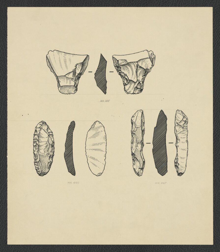
After the 1934 and 1935 West Kennet Avenue excavations archaeologist Denis Grant King drew up some of the flints found during the excavations. The flint drawings below show all the worked areas of the flints as well as cross sections of the flint. These drawings are a just few of the ones we have, they are all grouped together under Accession Number: 20004991.
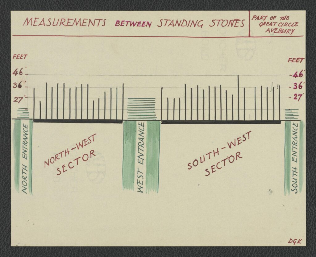
The graph below, accessioned at 20000573-014-001 was also created by Denis Grant King. The graph shows the distance between the standing stones in the North West and South West sectors of Avebury.
Whilst we know little about the map below, we do know it was produced in 1935. The map itself shows the path of 32 different historical sea voyages dating between 600 BCE and 1906. It shows everything from Columbus’ voyages to Hudson’s discovery of the Hudson River! It’s not clear why exactly it’s in the Keiller archive, but someone must’ve thought it was of interest at some point in time – perhaps it helps us think about Avebury in context of world history?